Habitat diversity explained: definition and real plant examples.
Habitat diversity is the variety of different habitats, such as forests, wetlands, grasslands, and dunes, within a given area. A habitat is the place where an organism lives, so a landscape with many kinds of places has high habitat diversity. It is often taught as one of three levels of biodiversity, alongside genetic diversity and species diversity. It matters for plants because each habitat has its own soil, water, and light conditions, and different plant species thrive in each. A stretch of coast with mangrove belts, salt-marsh scrub, and sand dunes has greater habitat diversity than a uniform landscape of the same size.
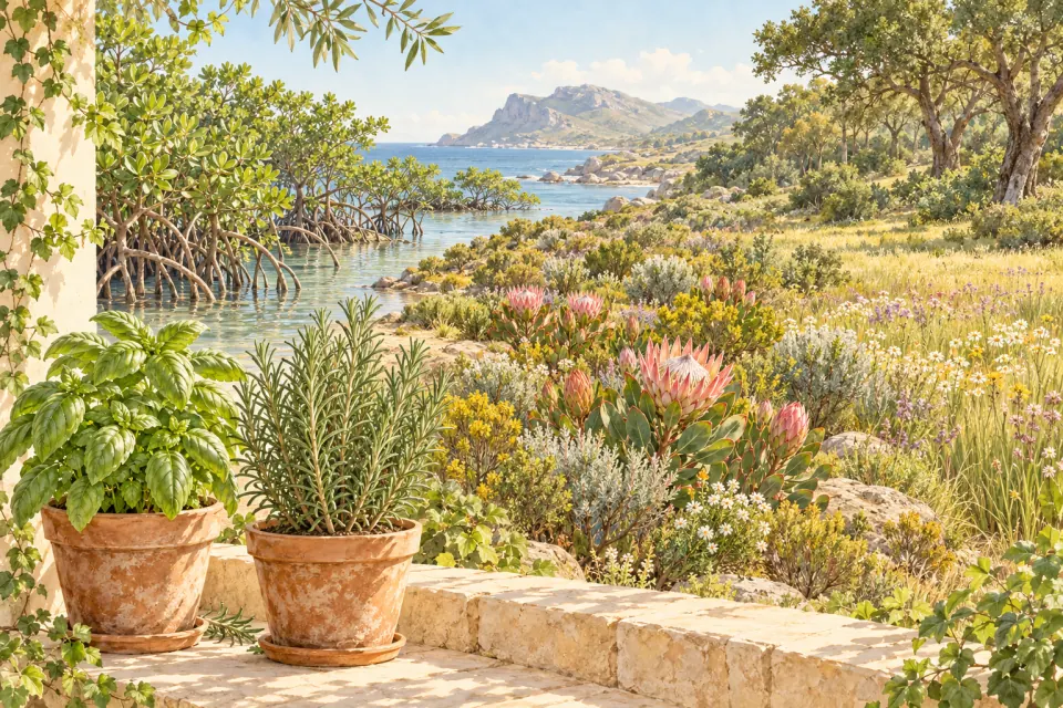
What is the definition of habitat diversity?
Habitat diversity describes the number of habitat types present in an area and, in stricter uses, how much space each type covers. The Convention on Biological Diversity defines biological diversity as the variability among living organisms, including diversity within species, between species, and of ecosystems. Habitat diversity belongs to that last part: the variety of places where life can exist.
The three levels are easy to confuse, so here is how they differ.
| Level | What it describes | Plant illustration |
|---|---|---|
| Genetic diversity | Variation in genetic material within one species | Wild populations of one species that differ in traits |
| Species diversity | The number of species and how abundant each one is | A meadow with 40 plant species instead of 5 |
| Habitat diversity | The variety of habitat types in a region | A valley with wetland, woodland, and dry grassland |
Two regions can hold the same number of species today and still differ in habitat diversity, and habitat diversity influences which species and populations can persist in a region.
Habitat diversity, habitat richness, and habitat heterogeneity
These terms are often used interchangeably, so it helps to separate them. Habitat richness is a simple count of the habitat types present. Habitat diversity, as used in farmland biodiversity indicators, reflects both the number of habitat types and the area each one occupies. A farm with five habitat types where one covers 95% of the land is less diverse than a farm where the same five types are spread more evenly, even though both have the same richness.
Some ecologists object to the term itself. They argue that a habitat is a species-specific concept and prefer environmental heterogeneity to describe the varied conditions within a landscape. This article uses habitat diversity in the general textbook sense.
Habitat diversity examples with real plants
Fynbos and renosterveld in the Cape Floristic Region, South Africa
The Cape Floristic Region, at the southwestern tip of Africa, holds about 9,000 vascular plant species, and roughly 69% of them are endemic, meaning they grow nowhere else. Most of this richness is concentrated in a handful of fynbos vegetation types, with a further share in renosterveld.
Fynbos is a fire-prone shrubland of hard-leaved evergreen shrubs on nutrient-poor sandy or rocky soils. Renosterveld is a shrubland of the region’s richer, clay-based soils and has been largely converted to farmland. Fynbos depends on periodic fire to regenerate, and many species flower strongly after a burn. Differences in soil and fire history divide one region into several habitats, and each habitat carries its own plant community.
Mangrove zones on tidal coasts
Mangroves show habitat diversity on a much smaller scale. At Pichavaram, on India’s southeast coast, the mangrove vegetation is usually described in three zones: a Rhizophora zone, an Avicennia zone, and a Suaeda zone on the saltier, drier ground. In the Neotropics, red mangrove (Rhizophora mangle) typically dominates the seaward fringe, while black mangrove (Avicennia germinans) dominates stands further inland.
Field studies and planting experiments have found that the depth and duration of tidal flooding, together with how well seedlings establish, help explain this zonation. Small differences in flooding create separate plant habitats within a single forest.
A garden-scale illustration
This one is a thought experiment, not a study. Picture a plot with a sunny, dry border, a shaded corner under a tree, and a damp pond edge. Drought-tolerant herbs suit the border, ferns suit the shade, and rushes suit the water’s edge. That plot holds three habitat types in a small space, while a mown lawn of the same size holds one.
What low habitat diversity looks like
Monoculture farms, closely mown grassland, and plantations of a single tree species hold few habitat types. Land use shows up at large scales too: a Europe-wide analysis of terrestrial habitat types reported that areas with high human population density tend to have low habitat diversity. Habitat diversity can also be low in places that are naturally uniform, such as an extensive reed bed or a salt flat; there it is a characteristic of the place, not a sign of damage.
Why habitat diversity matters
Reviews of studies comparing habitat diversity with animal species diversity generally find positive associations, although the strength of the effect varies with the animal group and the spatial scale studied. Plants contribute to this by forming the structure of many habitats: the canopy, shade, flowers, and leaf-litter layers that animals use.
Habitat types are also a practical unit for conservation. European nature policy, including the EU Habitats Directive, lists habitat types as a way of protecting ecosystems rather than protecting species one at a time.
How ecologists measure habitat diversity
Measurement begins with a map of the habitats. Researchers tally the habitat types present in the landscape and then weight each type by the area it covers, often with a Shannon-type diversity index. The result depends heavily on how habitats are defined and mapped, so figures from surveys that use different habitat classifications should not be compared directly.
Using plants to read a habitat
Plants often mark where one habitat ends and another begins. At Pichavaram, the zones are named after the dominant plants found there. As you walk, notice which plants grow together and where the mix changes; these boundaries often signal shifts in soil, water, or light.
A photo-based tool such as Doofer’s plant identifier can suggest possible names for the plants you photograph. Automated suggestions can be wrong, so verify any unfamiliar or potentially hazardous plant with a regional flora or a qualified local expert before relying on the name. The tree and shrub identification guide shows which features to compare for woody plants.
Frequently Asked Questions
Answers to common questions about plant care and this tool.
Related plant guides and tools
View all guides

Further reading and references
- Convention on Biological Diversity, Article 2: Use of Terms — Secretariat of the Convention on Biological Diversity The treaty definition of biological diversity, including diversity within species, between species, and of ecosystems. [Source ]
- Cape Floral Region Protected Areas — UNESCO World Heritage Centre Describes the region’s exceptional plant richness and endemism and the role of fire in fynbos ecology. [Source ]
- The Habitats Directive — European Commission, Directorate-General for Environment Explains how listed habitat types are used as conservation units in the Natura 2000 network. [Source ]